
Close when done viewing. |
NOTE: As of 04 Jun 2003, these maps are fairly stable. Need to check placement of The Cave on the Morden Chain map. Most current Rev dates are 03 Jun 2003 for both maps. |
MAPS |
Map LinksBelow is old stuff, but VERY accurate. Satellite maps with GPS coming soon.
MordenThese will load into your current browser window. You will need to use your BACK button to return to this page.JPG 2000x1500 403k GIF 1000x750 170k GIF 800x600 123k TIF 2000x1500 2.9 MB! Depending on browser settings, plugins, etc., the tif may load into your browser, or you will be prompted to save it to a file. Do whichever happens.
Intended for on-screen viewing,
these links will pop up a new browser window.
Just close it when you're done.
You can continue thru the site in this window,
using the new window as a reference when needed.
Morden ChainDownload for printingGIF 1500x2000 205k View in pop-up window GIF 600x800 70k
|
|
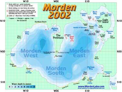
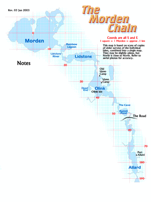
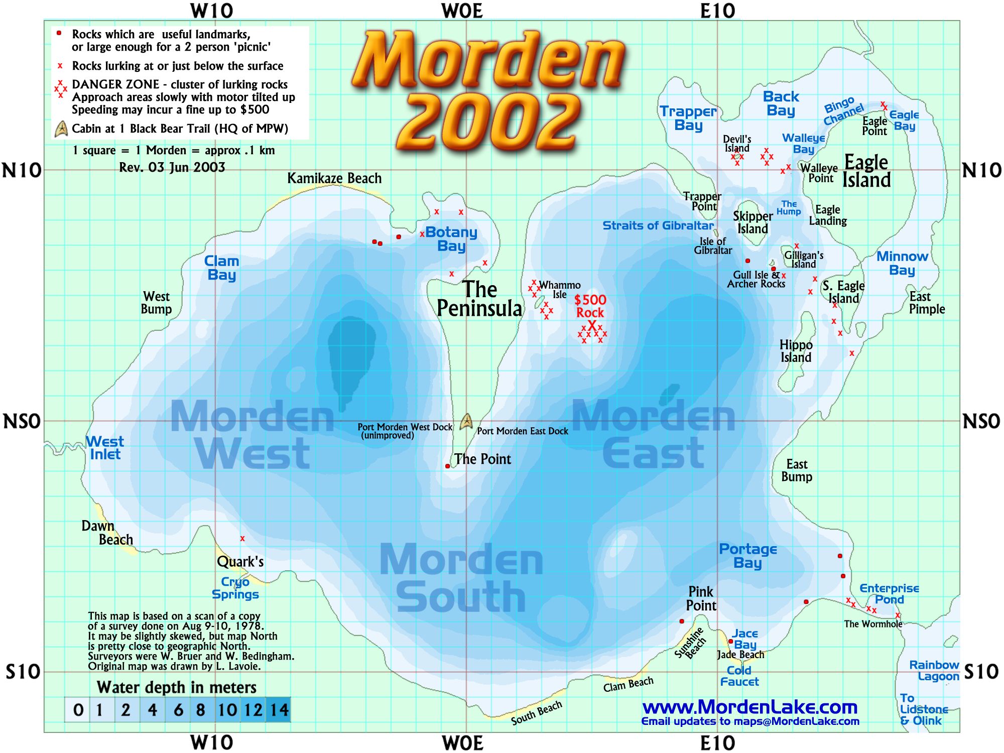
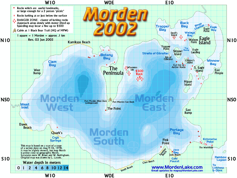
About Place NamesAfter a few years, we got tired of trying to tell people in the other boat that we just nailed a half-dozen mondo Northerns "about a hundred feet off the big rock that's just past the tree sticking out of that big island that's just behind those two little islands where we caught all those walleyes yesterday"!!So we started naming things. Some decades ago, we also established an arbitrary coordinate system (before widespread GPS). Also "far side", "behind" or "back side" means the side away from the cabin. GPS coords will be available for these (Examples) West Inlet is at S1W15, there's a BIG ROCK lurking unseen just behind Gilligan's Island at about N7E13, and speeding thru the area at N4E5 has been known to result in a $500 fine. Check with your friendly outfitter for current insurance deductibles for below-water-line motor damage! By all means, have fun, make up your own names, but be aware that all references on this site will use the names found on this page. Peggy, I'm naming the Northern end of Allard "Peggy's Practice Pond" from 1984 when the northern didn't know you were just practicing casting. Honey, feel free to jump in if there's anywhere that strikes you. |
|
Built by Transgalaxy Productions |